Nature on steroids: four days through-hiking the Berg Lake Trail

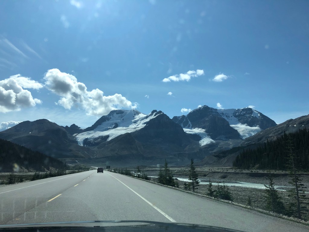
Often considered one of Canada’s most beautiful hikes, the Berg Lake Trail took us through a temperate rain forest, past waterfalls, glaciers and turquoise lakes whilst in the shadow of the highest peak in the Canadian Rockies, Mount Robson.

Land acknowledgement

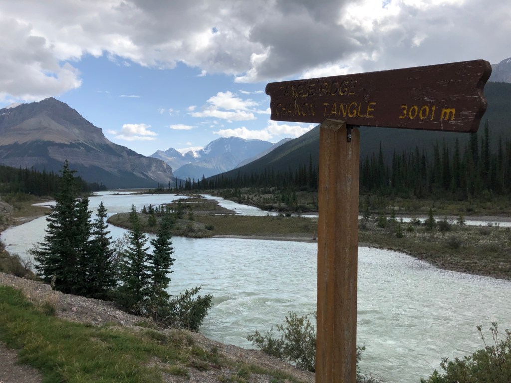
Robson Valley is in the traditional territories of the Simpcw First Nation, the Lheidli T’enneh Nation and the Red Bluff Indian Band.

The climax of the Berg Lake Trail
The climax of the first day: Kinney Lake

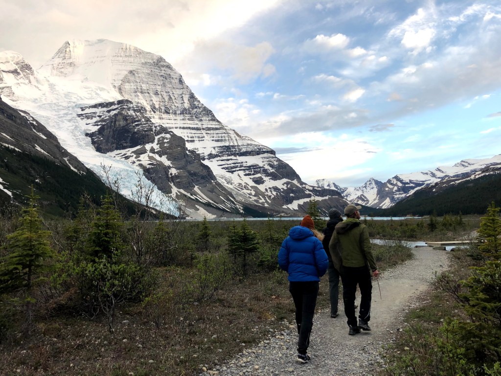
It is late afternoon and after two days of hiking we are just about to arrive at the Berg Lake campsite.

My feet have reached that point where each step is creating an angry rub and my boots weigh me down. I feel like a small child wearing a gigantic pair of workman’s steel-toed boots.

Meanwhile, my mind is doing that thing it does after a long day hiking: fixating on stopping, imagining with great intensity what it will feel like to take off my socks and slip my feet into a cool stream.

And yet all I can do, all any of us can do, is smile.

We are walking towards one of the greatest views I have ever seen. One of the greatest views there is to see: Mount Robson, highest point in the Canadian Rockies, Berg Glacier and Berg Lake.

James and Courtney looking at Robson Glacier
Berg Lake and glacier with Mount Robson hiding behind the clouds, from the ridge above

The Berg Lake Trail

I had first heard about this trail nine months earlier when, knowing I was going a little stir crazy in quarantine, a thoughtful friend sent me an article she had come across about it in the guardian.

Roll on five months and after knowing James and Country, who you may remember from this camping adventure, just a few weeks they popped the question to Jacob and I: “Do you want to do the Berg Lake Trail with us this summer?”

Yes, yes we did.

Emperor Falls

The adventure begins

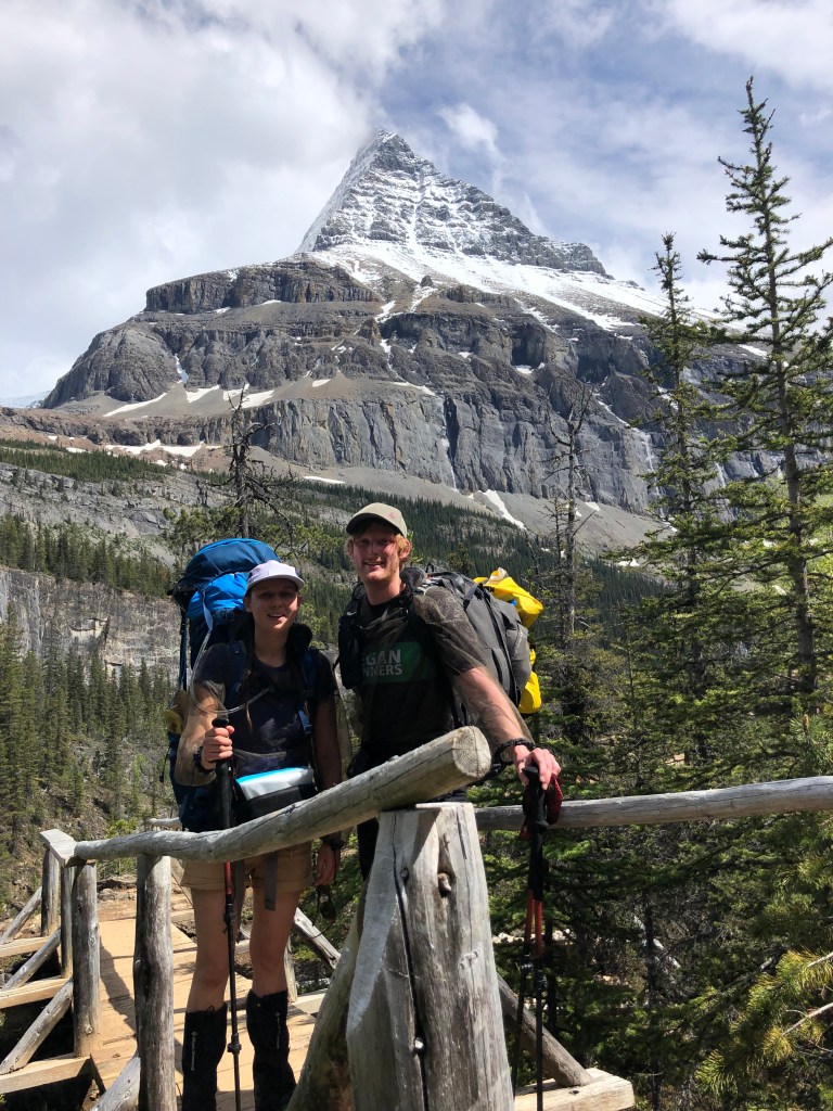
So in early summer of 2021 the four of us piled into their car with four large backpacks and drove the three-ish hours from Prince George to Mount Robson Provincial Park to complete what some people have called Canada’s most beautiful hike.

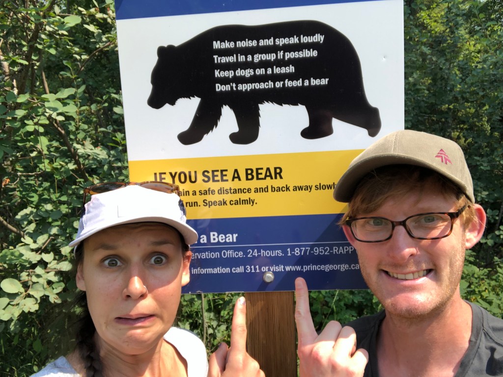
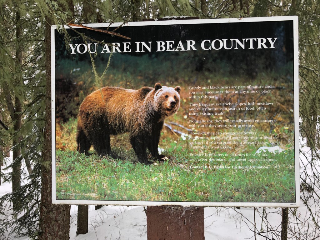
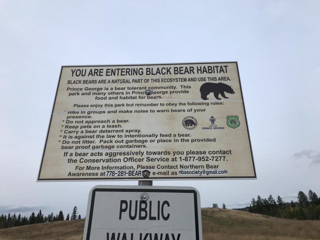
Registration and a quick briefing at the visitors centre completed, we made a mental note of where the Park Ranger said that a Grizzly Bear and her three cubs had been spotted a few days earlier and made our way to the trail head.

We would have four days on the trail, carrying everything we needed and camping at the designated camping spots along the way. Which for us was going to be one night at Kinney Lake and two at Rearguard.

Kinney Lake

Day one

Through the forest to Kinney Lake

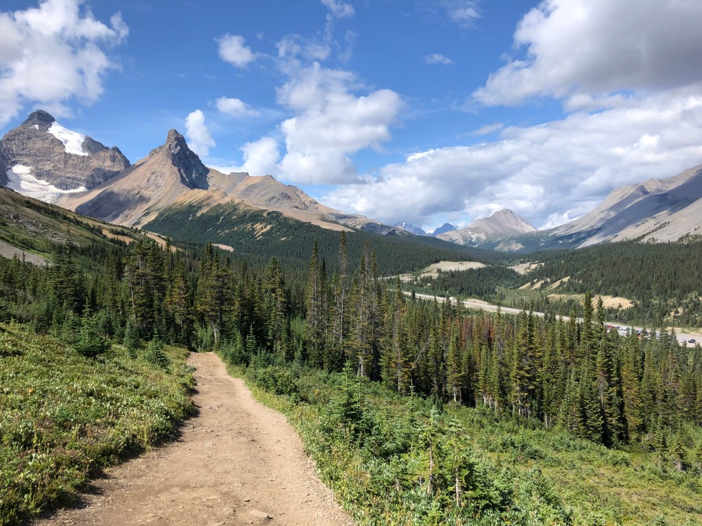
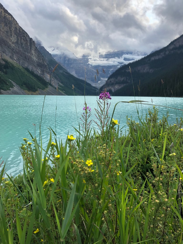
It is easy to overlook how enchanting the first leg of the Berg Lake trail – from the trail head to Kinney Lake – is because of the dramatic, tear inducing scenery that comes after. But the gentle incline through a temperate rain forest on a trail which winds along next to a stream and ends in the picture perfect Kinney Lake, is an exceptionally stunning hike in its own right.

For me, the shaded seven kilometers to Kinney Lake was an ideal way to remind my back how to walk with a heavy backpack on and prepare it for the more punishing second day!

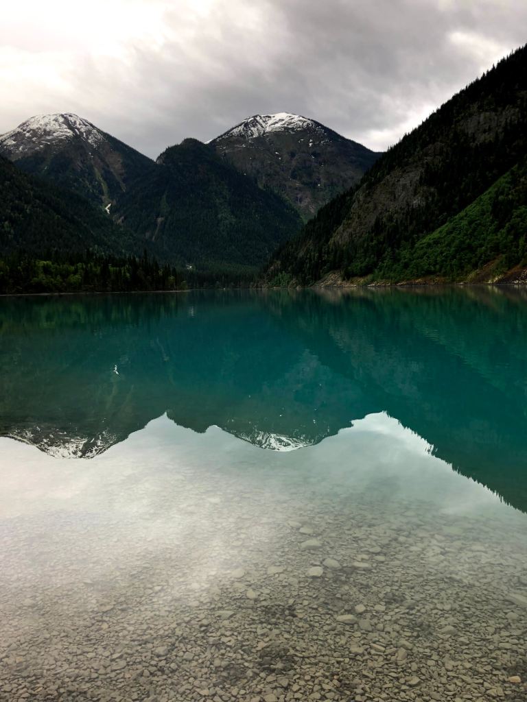
While it would have been possible to walk further the first day, how could anyone miss out on stopping at Kinney Lake to camp right beside its pristine, jewelled water.

Cooking in the shelter at Kinney Lake

An evening at Kinney Lake

Jacob, James and Courtney also could not resist taking a quick dip in the lake. I can’t remember why I didn’t join them. Oh yeah, the water was BONE CHILLINGLY FREEZING and clearly those three have a screw loose.

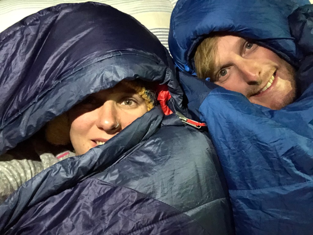
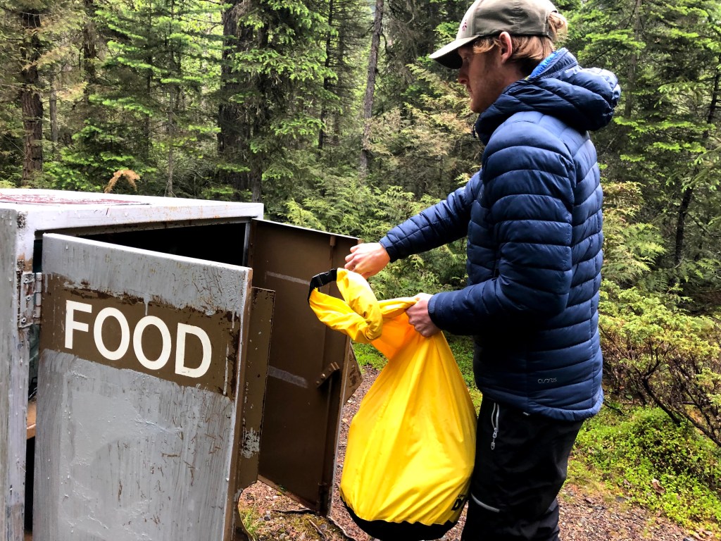
We tore ourselves away from our idyllic camping spots overlooking the lake to cook dinner in the shelter – a feast of refried beans which James had been excited about for days – before following the now familiar night time preparations for camping in bear country, many of them similar to those I explain in the story of our first camping trip in Canada.

Our camping spot at Kinney Lake
All bear attractants go into the yellow bag which is then stored in the food locker away from camping spots!
James on the swing bridge to Whitehorn

Day two

Cowboy coffee, birthday breakfast and Whitehorn’s wild flowers

On the second day, we opened the tent door to an absurd postcard view of Kinney Lake, still and silent, retrieved our food from the bear box and started making porridge by the lake. James and Courtney joined us by our tent to make coffee and be presented with their birthday badges.

As well as being the day we would be tackling the main part of the trail, hopefully arriving at Berg Lake in the early evening, today was James and Courtney’s joint birthday. With bellies full of porridge, camping equipment rammed back in backpacks and birthday badges adorned to hats, we set off for Berg Lake.

After around four kilometres of travelling deeper into the valley we crossed a swing bridge over the river and arrived at the Whitehorn campground. Another stunning spot next to the river, scattered with tiny wild flowers, a few tent pads and a view up the valley to mountains beyond.

Whitehorn campground

Up we go

After leaving the open vista and beauty of Whitehorn, we were quickly facing the switchbacks which weave there way through the forest as you climb up the Valley of a Thousand Falls.

James and Jacob, being more than averagely fit blokes, were leaving me in their dust. Courtney, it turns out, is not the human female I had previously mistaken her for, but something more akin to Lightening from Gladiators. Uphill, she is far faster that me, but also beats the boys!

This meant that as the switch backs slowly became more grueling, I was grinding along far slower than the others. But I am helped by the fact that this is not my first rodeo.

I have hiked long distances with a heavy backpack before and if I learned one thing from completing the Ten Tors challenges as a teenager, it was never, ever, take your backpack off. Do not take breaks, keep that hellish lump on your back and just keep trudging away slowly.

This meant that despite being far slower than Jacob, James and Wonder Woman Courtney, sometimes – due to my regime of going slow, steady and taking no breaks – I was ahead, alone.

During one of those moments, when the others were taking longer to enjoy the Falls of the Pool waterfall, I was suddenly hit by an overwhelming smell of garbage. Instantly thinking of bears, I panicked that – despite my Darth Vader puffing and panting – one might not hear me coming.

Excuse the sensationalism, but this may have been the moment that ‘Love Shack’ by The B-52s saved my life.

I belted out that tune until all the bears in the valley ran a mile! Not long after the others caught me up, which was good, because attempting to sing while hiking uphill was exhausting!

Crossing a bridge below Mount Robson

Chasing waterfalls

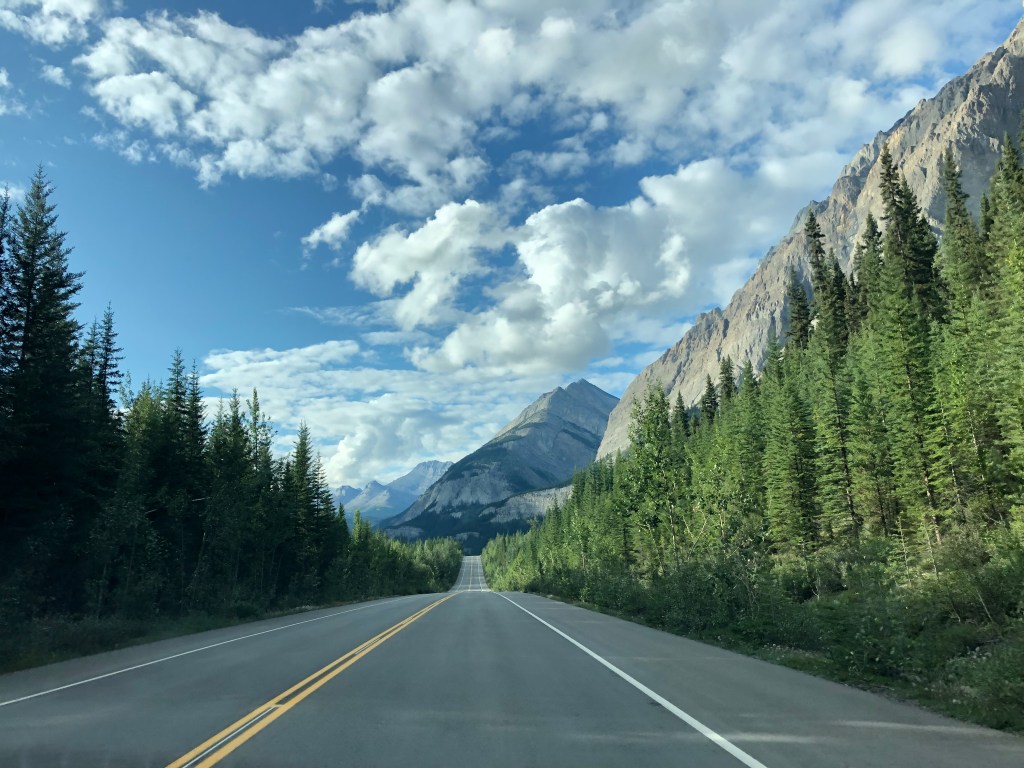
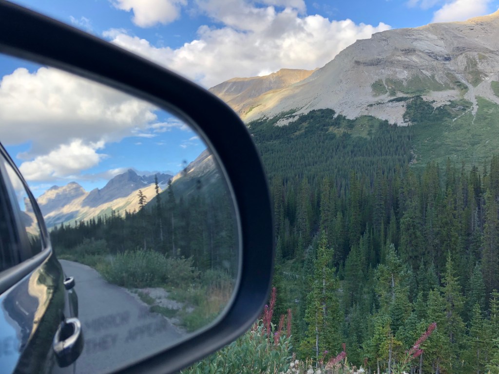
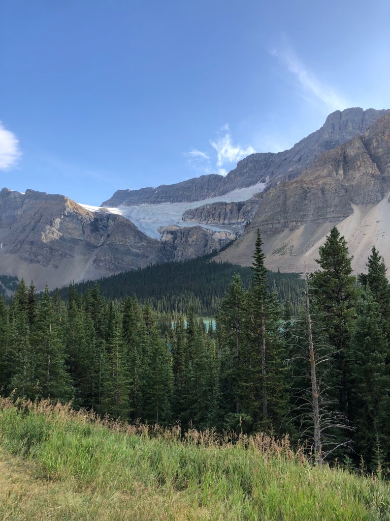
Much of the uphill climb is in the forest, however, every so often you cross a bridge and the trees clear allowing you the sight of Mount Robson towering over you.

The wispy clouds passing quickly meant that Robson’s peak flirted with us all day, performing an endless peep show. Each time it popped out we would nudge each other and stare up in wonder. We were walking alongside a giant.

Another reminder that we were deep in the Rocky’s, surrounded by mountains, was the occasional rumble of thunder which would break the quiet afternoon, as a avalanche of rock tumbled down a mountain; somewhere near enough to ring loudly through the valley, but far away from where we safely walked along the trail.

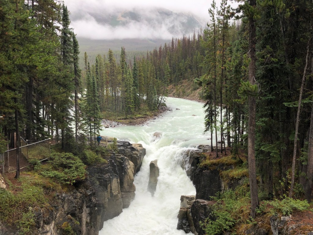
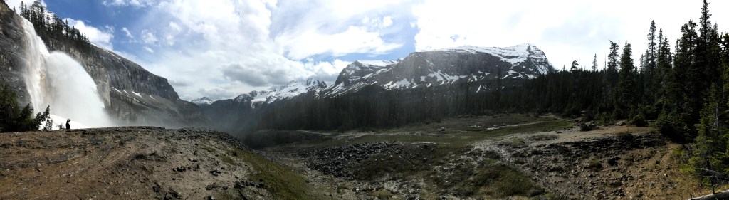
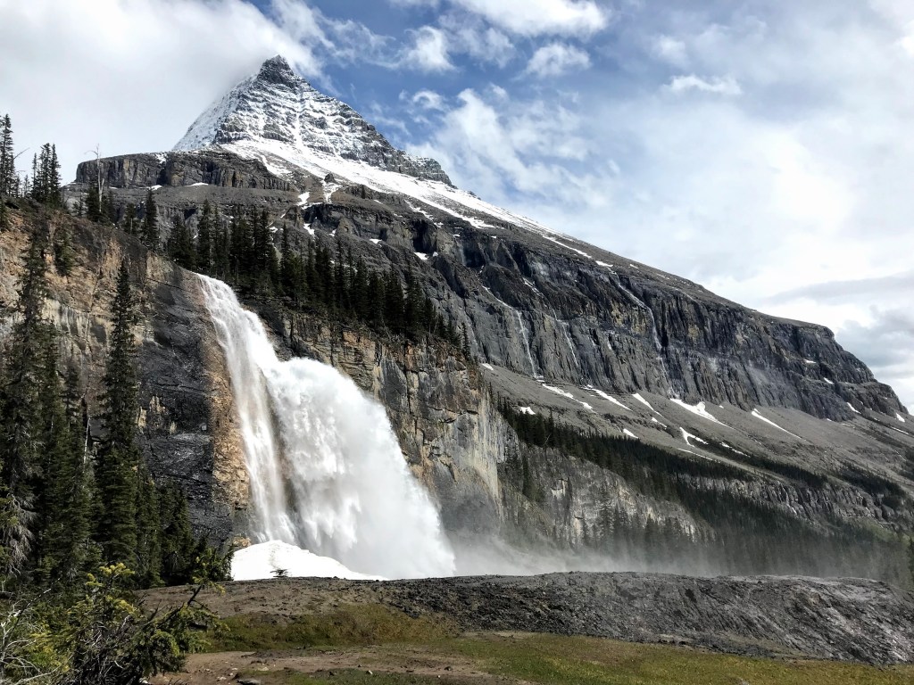
Mount Robson was not the only reward; as you would expect from a place called the Valley of a Thousand Falls. The highlight and end point of that section, Emperor Falls, makes every inch of you sore back scream, ‘it was worth it’.

A gigantic waterfall, so powerful the mist soaks you from meters away, Emperor Falls stands in front of Mount Robson at the head of a mountain lined valley. Not long after we had decided to hike the Berg Lake Trail together, Country had told us that when she had seen Emperor Fall on a previous occasion, she had cried. I could see why.

Emperor Falls’ other gift – aside from potentially reducing you to tears with it’s sheer beauty – is that it marks the end of the steep section. From Emperor Falls it is just 3 kilometers, on a less steep trail, to the moment you round a corner and see the sight you have been waiting for: Berg Lake and glacier.

Emperor Falls and Mount Robson
In the mist of Emperor Falls
Jacob, Courtney and James admiring Emperor Falls and Mount Robson

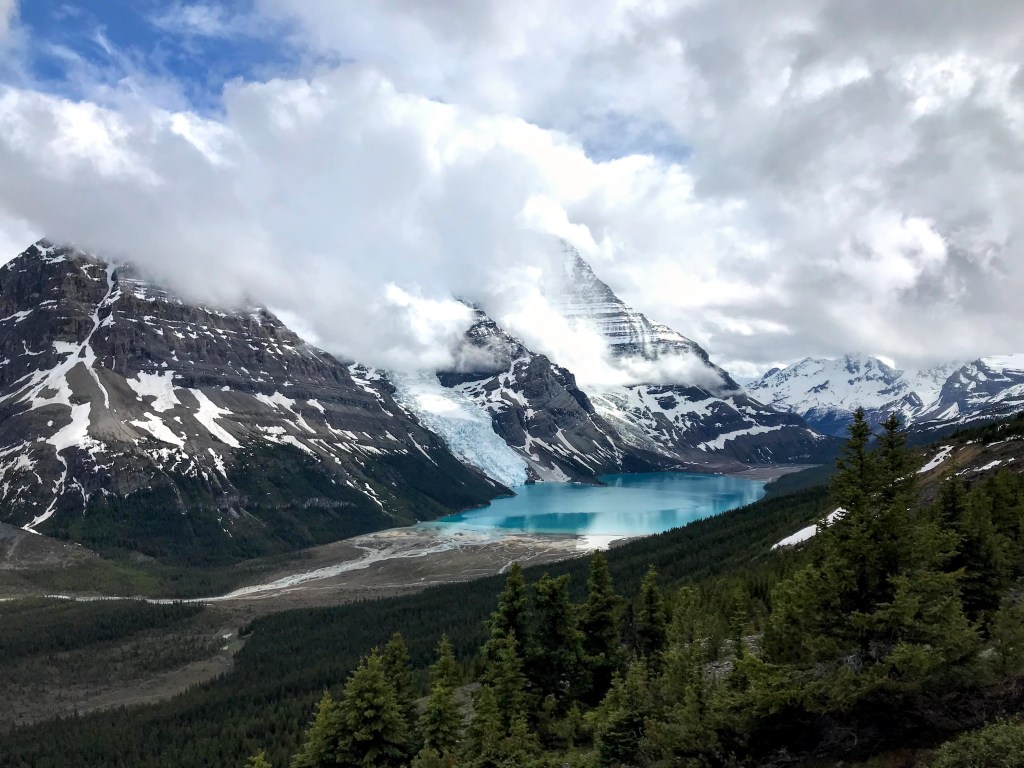
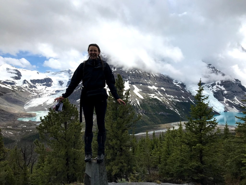
Arriving at Berg Lake

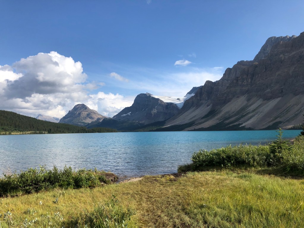
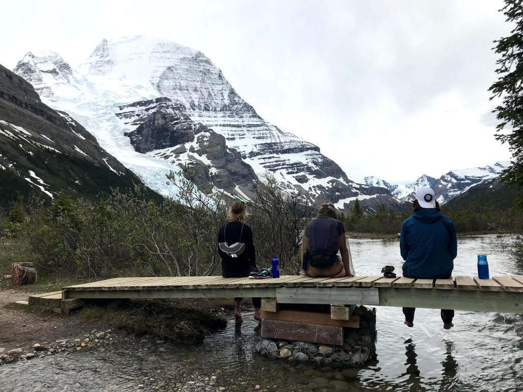
Robson is a satisfying mountain, the kind a child might draw if asked to. With jagged edges, false peaks and bands of snow. Berg Glacier, is spotless white and ice blue. It looks like the contents of a split bag of icing sugar that has come to rest in a precarious heap. At the bottom of the glacier, the lake is perfectly still and bright, with just a few of the small icebergs, which gave the the lake its name, gently floating along.

It is literally absurd. It is nature on steroids. But in this valley where each feature appears to be trying to out do the last, it is hardly surprising that the final end point is this breath taking.

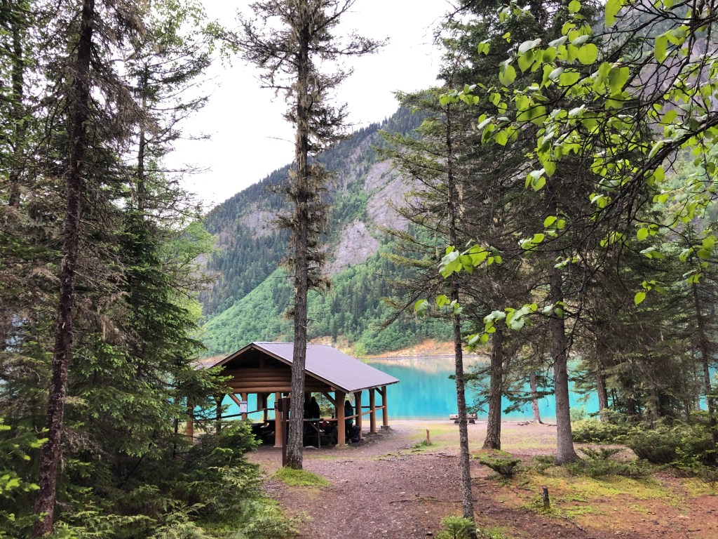
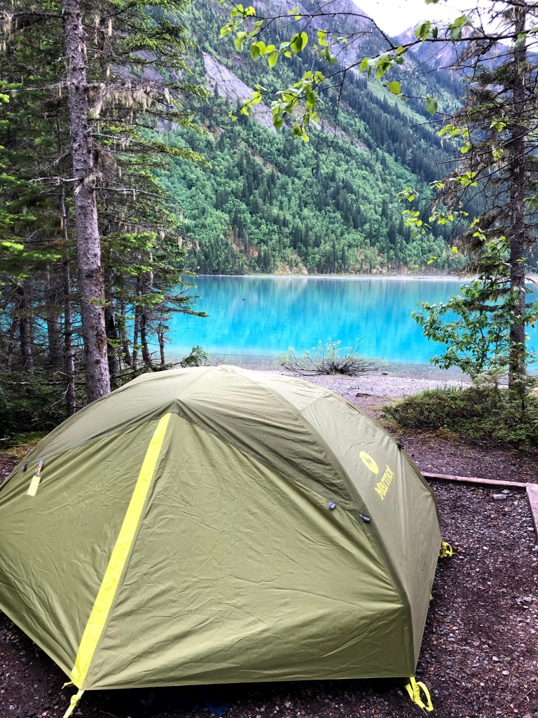
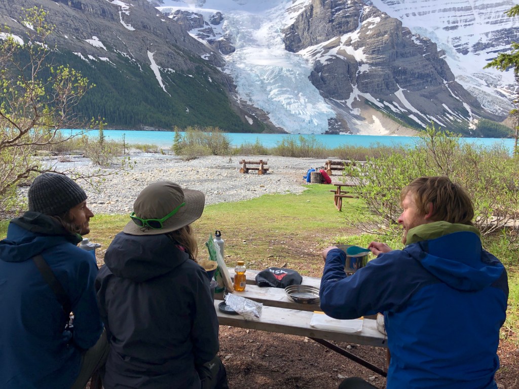
We walked the last kilometer from the Berg Lake Campsite to Rearguard Campsite, a quieter spot with just five tent pads, where we would be spending the next two nights.

Courtney, James and I dipping tired feet in ice cold glacier melt water

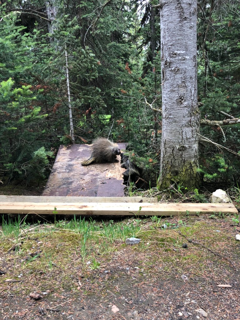
Porcupines and marshmallows

We dumped our backpacks down, started pitching the tents and discovered that some very squeaky neighbours were also enjoying the seclusion of Rearguard campsite.

Sitting near to two porcupines, watching them bickering over who gets to nibble which bit of wood and listening to their long squealed speeches to each other was a great pre-dinner show!

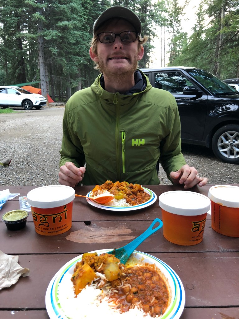
After some chilli, Jacob and I revealed the S’mores ingredients we’d brought as a birthday treat for James and Courtney! Gas stove toasted marshmallows leave quite a lot to be desired but washing them down with Fireball – hiker’s whiskey – and hot chocolate, helped!

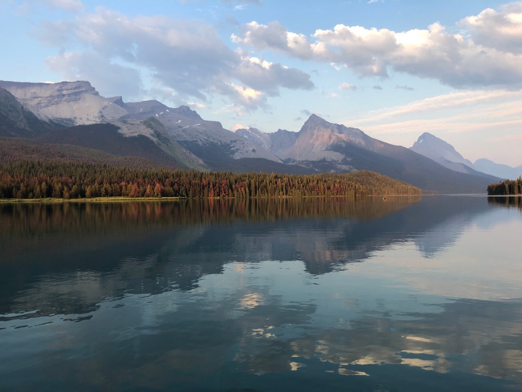
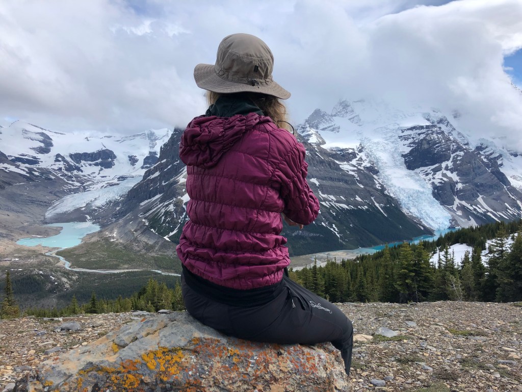
Soon after we had washed our sticky S’mores-fingers the sky cleared, Mount Robson’s snowy peak was visible and it was radiant in the last light of the day. We walked to the gravel flats in front of Berg Lake where we could sit, soak our tired feet in an ice cold glacial steam, and enjoy the incredible view.

Two porcupines we shared the campsite with at Rearguard
An evening stroll after we erected our tents at Rearguard Campsite

Day three

Robson Lake and Glacier

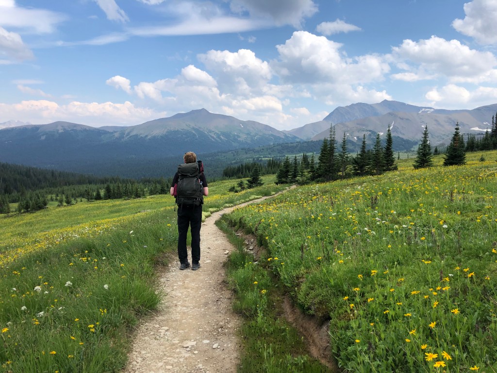
By staying two nights at Rearguard, James and Courtney’s clever suggestion, we were afforded a whole day to explore the remote, beautiful landscape around Berg Lake. Even better, as we did not need to move the tent to a new location, we had a whole day of hiking in the area without the strain of a heavy backpack.

Making use of this time, we planned two hikes for that day. The first of which was a hike towards the start of the Snowbird Pass, a trail which was closed when we were there to protect Cariboo carving grounds.

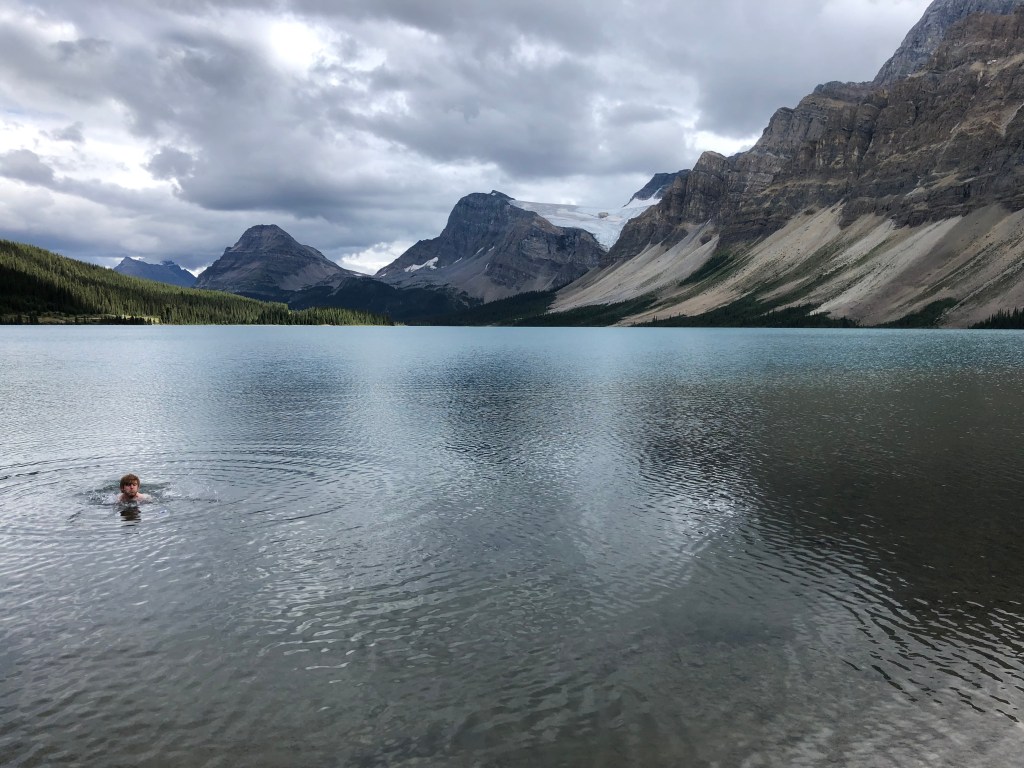
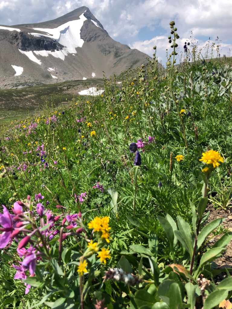
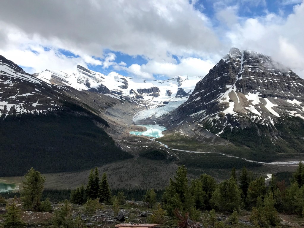
When we reached Robson Glacier, we sat and admired it, as well as some mountain goats who were grazing on the exposed ridge above the glacier.

As Jacob and James got a closer look at the glacier using James’ done, Courtney and I escaped the rain, which had began to fall, by sheltering in a rock cave where we ate Tamari Almonds and enjoyed the view!

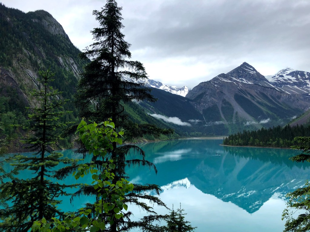
On our way back to the campsite, where we planned to refuel before tackling the next hike, we stopped for a closer look, and listen, to Lake Robson. The beautiful, half melted ice on the lake was making gentle, wind-chime like tinkling sounds as the tiny fragments of ice clinked together.

Robson Glacier
Icey Robson Lake, you can see the tiny pieces of ice that created the beautiful sounds at the bottom of the photo
Robson Glacier, a happy glaciologist and me!

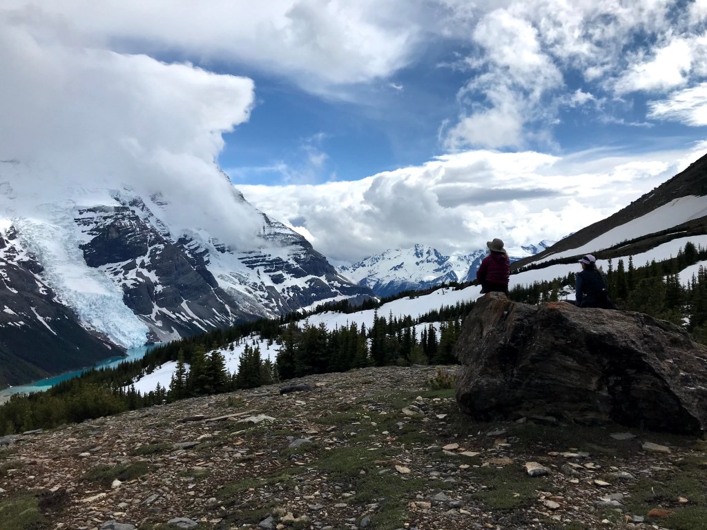
The best view of all

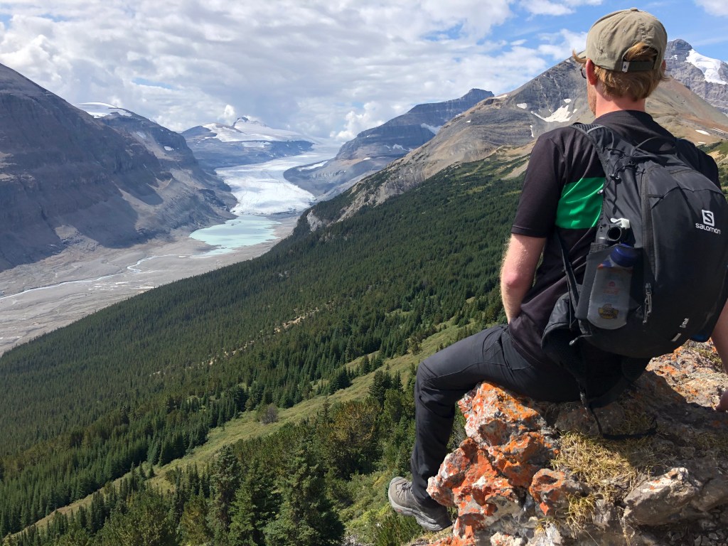
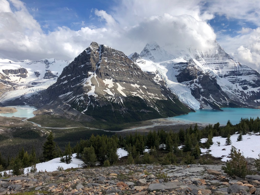
Our hike that afternoon gave us an opportunity to see this incredible scenery from above. We hiked up a steep trail through the trees until we were above the tree line, looking out over Mount Robson with a glacier either side of it, two lakes at the bottom of the glaciers and a river running between them.

We had hiked high enough, to take in the full scale of Mount Robson, in its unbelievable landscape and high enough to hit snow.

We had also hiked into a new province: Alberta. For the boundary between the provinces of British Columbia and Alberta lies on this ridge in Mount Robson Park.

Robson Glacier and Lake from the ridge
Courtney, me and a cloud covered Mount Robson
Robson Glacier and lake on the left and Berg Lake, Berg Glacier and Mount Robson on the right
Standing on the maker for the BC/Alberta boarder
Play time in the snow
Courtney looking at Robson Glacier and lake on the left and Berg Lake, Berg Glacier and Mount Robson on the right

Storms and noodles

We spent our final evening huddled under a tarp sheltering from the rain, eating noodles and passing round the last dregs of the Fireball as a storm came in to remind us that we were in the wilderness. All we could do was count the seconds between the lightning and the thunder and enjoy our final evening far from phone service, roads and flushing toilets!

Breakfast with a view on the final day

Day four

Breakfast at Berg

The final day would see us retrace our footsteps through the valley, without stopping at Kinney Lake to camp this time, back to the trail head. But we had one last morning of wilderness bliss: breakfast on a bench in front of Mount Robson, Berg Lake and Glacier.

It may have been the impact of that first morning cup of tea, but the glacier seemed bathed in a magical light and, as the sun shone down, it sparkled.

It was harder than I expected to turn our backs and walk away from that sight. But, the immense feeling of gratitude for having seen those views came with me as we walked back to the trail head; they were still with me when we crossed the bridge into the parking lot, had a group hug, and I burst into tears.

Passing Berg Lake and Glacier on the way back

. . .

Join us for another adventure…

A Nordic ski paradise… just eight minutes from our home

Camping in bear country: an ode to mountains and mates

A snowy day hiking in the footsteps of First Nation traders and conquering my fear of the cold

. . .

Lots more adventures to come, subscribe and never miss a story…

The time we came face to face with a bear

This time last year I had never seen a wild bear in my life! After a full spring and summer living in Canada, we’ve had a fair few encounters. But this particular one will live on in our minds as one of the most outrageous moments of our lives!!

Before that day…

By mid July 2021, when this encounter took place, we had seen a few bears from a distance and had lots of experience with being ‘bear aware’ while hiking and camping. You may remember some of the bear precautions I explained in the story about our first time camping in bear country.

It was on our way back from that trip that I saw my first black bear, a large male, grazing nonchalantly on the road side.

After this, the sightings came thick and fast.

One of my favourite sightings was a mother and a cub that were crossing a large field. A safe distance away from them, we pulled over, sat on a fence and watched them slowly making their way through the open field and into a dense forest, bears preferred habitat.

It was wonderful to watch the way they stuck their noses in the air like dogs, probably taking an interest in the smell of us that was carried on the breeze to them.

After that peaceful encounter, it was amazing to see a bear sprint when one ran out in front of our car not far from Prince George. Seeing such a large animal move so quickly and with such agility was startling. It was also a helpful reminder why it is pointless to try and outrun a bear.

Which brings me to our story. Which took place during a quick lunch time walk in mid-July, 2021. In a forest called Moore’s Meadow, which is very near where we live, in fact, you may remember it from my stories about about snowshoeing last winter.

Spot the bear marks!
Some more marks left by bears!

That time we came face to face with a bear…

It’s face popped up above the bush. The bush that lined the path that we were walking along. I was just the other side of the bush and Jacob was next to me.

Looking back it feels like we stared at each other for minutes. My processing went into a simplistic state and I remember every single thought I had in that nano second that we stood looking at each other:

Face? Animal. Bear? Yes, that is a bear. This is real. Nose colour? Tan. Black bear. A real black bear.

At this point Jacob, who was standing the other side of me, realised I had stopped, paused, turned to me, saw that I was face to face with a bear on its hind legs poking its head over a bush, and said in a calm, quiet voice: “Oh it’s a bear”.

Black bear. For real. Danger.

Its head was double the width of mine and it was the only part of it that was visible above the bush. Its ears were pricked up. I remember registering how small they were, how they were quite comical in comparison to the size of its head. It was stock still, just staring, as our brains switched from ‘this is real’ to ‘what do we do’ and our instincts kicked in.

Black Bear. Take cap off bear spray. Back up slowly. Speak in a low, calm voice. Don’t turn around. Don’t run.

Staying calm was surprisingly easy because it was not moving. It just stood there staring. So we spoke to it in a low, steady voice, bear spray pointing right at it and backed away calmly.

Large bear. Maybe female. May have a cub. Don’t turn around. No, do turn. Turn to check the cub is not behind us.

Turning around is firmly on the list of things not to do when you encounter a bear; but so is coming between a mother and her cub. Mothers will do literally anything to protect their cubs. So I reassured myself that we were not in more danger than we realised by turning quickly to check that there was no cub behind us.

As we continued to back up calmly, talking to it, the bear disappeared behind the bush, causing my chest to tighten in panic. Now we were dealing with a bear we could not see.

Stay calm. Keeping talking to it. Stay calm. Keep backing up. Be ready to use the spray if it runs at us. Stay calm.

But her intensions became clear when a much smaller bear, as yet unseen by us, began climbing a tall tree next to where she was. We had stumbled upon a female bear and her cub, and now she was sending it up the tree to safety.

By now we had walked backwards as far as we could. We could no longer see the mother, but we knew she was there because she would not leave her cub who was still climbing the tree.

In comparison to its still, silent mother who we knew was watching us, the cub was noisily scrambling higher up the tree; breaking off smaller branches as it went. It’s carefree, loud climbing was a strange contrast to the tension below.

With bear spray in-hand and hearts still racing, we had to bushwhacked our way out of the forest to safety!

Caught red handed! A bear in the apple tree in our garden – captured by our friend/landlord who lives downstairs!
A bear in a tree – captured by our arborist friend who was called to the scene!
You may have to zoom in to spot this curious young bear!
The mother and cub we watched crossing a field

Since that day…

Needless to say, we have not (and hopefully will not) come any closer to a bear than we did that day.

But we did have our first Grizzly Bear encounter not longer after. We were with friends, making our way to a spot to pick wild blueberries when we spotted a Grizzly mum and her cub. They were a long way down the path from us, but you don’t mess about when you see a Grizz!

We must have looked like six meerkats as we crouched among the low blueberry bushes, spontaneously popping our heads up to check for them and call out to let the bears know that we were there.

Bears are particularly active in the autumn/fall as they attempt to eat as much as they can before going into hibernation. The colder it gets the more overturned garbage bins we have seen! The apple tree in our garden was raided every night for a week, leading to a damaged fence and a fair bit of bear scat for Bally to sniff!

We also had another bear encounter just five minutes walk from our house, when a curious yearling came out of the bushes we were walking by. We did the usual: speaking in a low, calm voice etc but as we moved away the cheeky young thing ran towards us and only backed off when Jacob shouted at it.

Winter is not here yet, there is plenty more fattening up for the bears to do before they hibernate! In fact, just this morning we went outside to find a big pile of bear scat in our front yard and so I expect we might not have seen our last bear of this season just yet!

A sign in Eskers Park, not far from Prince George
A warning sign outside Moore’s Meadow where we had the encounter!
Another reminder outside Moore’s Meadow!

. . .

Some more musings on life with bears…

Camping in bear country: an ode to mountains and mates

A teapot for a birthday: A spring hike in Bear Country

A guide to the Icefields Parkway to celebrate the opening of the Canadian boarder

Subscribe for more wild stories from Northern BC…

A guide to the Icefields Parkway to celebrate the opening of the Canadian boarder

The time has come to start planning your dream Canadian road trip and you cannot miss out the incredible Icefields Parkway! Below are some tips and tricks to help you plan the drive of your life.

The Icefields Parkway
Views in every direction!

My first travel guide

During the entire time we have lived here, Canada’s international boarder has been closed to non-essential travel due to Covid-19. Naturally, I have not written any travel guide blogs since they would have been about as much use as a chocolate teapot!

But earlier this month, on the 7th September 2021, the Canadian boarder opened.

It’s finally time to get excited about travel again! Start planning those Canadian road trips people!

And if there is one place you have to add to your itinerary, it’s the Icefields Parkway.

Whether you will be exploring with children, adults or adventuring virtually from the comfort of your arm chair, there’s something here for everyone. I complied this guide after we returned from our trip this summer, it covers…

  • Basic information about the Icefields Parkway
  • Considering whose ancestral home the Icefields Parkway is
  • Why you should forget the itinerary
  • Some money and time frame things to consider
  • Safety points
  • Things you can see from your car
  • Things you can see a short walk from your car
  • How to get the essential things you may need
  • A short, child-friendly hike
  • Things you could consider skipping and places we missed
  • A challenging day-hike and a challenging through-hike
  • Some thoughts on Lake Louise
  • Tips for getting started

Happy planning!

The Icefields Parkway: basics for beginners!

The Icefields Parkway (IP from now on!) is a 230km road which connects the Banff and Jasper National Parks in Alberta, Canada. The northern end of the IP falls in the town of Jasper, which is just a four hour drive away from our home, Prince George.

Google ‘best drives in the world’ and this road, highway 93, will be listed. After four days travelling up and down it, as it weaves its way through the Rocky Mountains, past glaciers, forests, turquoise lakes, wildflower meadows and, often, some impressive Canadian wildlife, I can see why.

Consider whose ancestral home you are having the time of your life in

Diverse groups of indigenous people traditionally, and currently, lived, worked and cared for this part of the Rocky Mountains.

Historically, some groups lived in the mountains year round, while others travelled to them to access resources, ceremonial sites, mountain passes or to meet with other groups.

You can show your consideration and respect for the people whose ancestral home you are holidaying in through small acts.

One way is by refraining from buying dodgy ‘indigenous art’ from a tourist shop where the money is clearly not going to an indigenous artist. Trust me, you’ll know which shops I mean when you are in them.

Another way might be by explaining to children which band traditionally lived in a particular area or the indigenous names for the mountains you can see.

This article is about some Pipe Ceremonies that were held by a Stoney Nakoda man, but it has a wealth of other information such as place names, illustrating how easily you can find this information online.

The Two Brothers Totem Pole in the town of Jasper

Rip up the itinerary

Before you freak out that I’m suggesting you don’t create an itinerary for your trip, let me give you a quick overview of how we spent four days on the IP.

Day one: Drove from Prince George to Jasper. Stopped in Jasper for fuel then drove down the IP to Lake Louise. Stopped at lots of pull-ins to enjoy the view and take photos. Did the short walk to the toe of the Athabasca Glacier, stopped at Bow Lake and Lake Louise. Camped in Lake Louise.

We had not expected to see anything due to forecast of rain for that day. But the weather was great so we stopped lots!

Day two: Drove from Lake Louise to the Bow Lake area to do a challenging day hike in the Banff National Park part of the IP. We thought about camping near there, but decided to camped at a site we love in Jasper. Drove all the way back up the IP to Jasper.

Driving back up the IP in the late afternoon sun was wonderful and going in the other direction from yesterday meant that we spotted new things!

Day three: Drove back down the IP to do the Parker Ridge hike. After we completed it, we drove all the way back up the IP to Japser again. We thought about doing the two waterfalls, but decided to save them for tomorrow! Camped at the same site in Jasper after beers at the Jasper Brewing Co. and an Indian takeaway back at our campsite.

Day four: After breakfast in a café in Jasper, we drove back down the IP to see Sunwapta Falls and Athabasca Falls. Then back up the IP one final time before the drive home to Prince George.

As it was overcast and rainy on the final day, we were glad we’d already seen so much on the other days!

Did you count? It was six! We drove up and down the IP (not all of it each time, but a reasonable portion) a grand total of six times.

This was because we let the weather dictate what we did each day. The weather changes amazingly fast in the mountains and the forecasts are less reliable.

In short, create a list of what you ideally want to see and do while you are in the IP area. But be flexible about which day you do things and in which order. See the IP as an area you are exploring by going up and down it, rather than a road to travel and stop along once.

Each time we drove along the IP the light played differently on the mountains and the clouds parted to reveal previously unseen peaks.

Besides, no matter how many times you go up and down, it will never be enough.

Crowfoot glacier

Time of your life

Although I just told you to forget about making an itinerary, you will still need some idea about how much time to allocate to exploring the IP.

The IP could be driven in a morning, but that would be a crime! Factor in at least a whole day to complete the drive slowly enjoying every view and stopping frequently to take photographs.

I recommend having a second day for going back to those places you would like more time to explore (and those obscured by cloud on your first day!). This could also be an opportunity to see some of those beautiful places, such as the waterfalls, which are a short walk from the car park.

You may also wish to leave yourself a whole day to complete a challenging hike or, if it suits your group better, two moderate hikes with a stop for lunch!

You really do not need to summit a mountain to get incredible views (see the short, child friendly hike below). But, giving yourself a full day for a hike or two would allow you to expirence more of this incredible mountain range.

By my count that’s three days. But shorter could work and longer would be fantastic.

Time for tea at Whistlers campsite in Jasper

Money, money, money

As with many tourist sites worldwide, things can be noticeably more expensive in Banff and Jasper National Parks than elsewhere in Alberta and British Columbia.

The cost of front country camping can be high, but the facilities, particularly at the newly renovated Whistlers Campground, will help make up for the sting on the wallet. Picture a warm, clean shower at the end of a long day hiking in the backcountry and you know why we were happy to cough up.

A key thing to take into account when you are making a budget, is the cost to enter the parks. That’s right, you’ve got to pay to enter both Banff and Jasper National Parks. And they charge you pay person, per day! When we were there it was $10 each a day. You were warned!

Who cares about cost when you’re this cosy!

Safety First

Jasper and Banff National Parks are teeming with animals. Both Grizzly and Black bears roam free in this wildlife haven. This means that in summer you need to take bear spray. But more importantly, you need to know how to use it (YouTube can help with this).

Know how to distinguish between a Grizzly and a Black bear, this will determine how you react when you see them (again, there are lots of great YouTube videos to help with this). Make lots of noise when you’re on the trail, let them know you are there and most bears will try to avoid you.

You don’t need me to tell you that the weather changes fast in the mountains, you need waterproofs even in the summer! We experienced snow on the summit of a mountain in August!

Watch out for the Jeremy Clarkson wannabes and give these people – who think the IP is for rally driving – a wide birth! Seriously, even ever-patient Jacob got fed up with the reckless driving.

Unfortunately, on our second morning we saw what can happen when idiots treat this wildlife sanctuary like a race track: a dead grizzly bear on the side of the road.

Safely first – Keep away from Elks during rutting season!

Things to see from your car

As the IP cuts it’s way through the Rockies you can see a great deal without leaving your car. The jagged peaks go on for miles and you can also get your fill of glacier action as they are perched on top of many of the mountains which line the roadside.

Athabasca, Bow and Crowfoot glaciers were among the most memorable which tease you from the roadside. You’ll also see plenty of ice blue glacier-fed lakes!

Keep your eyes peeled for wildlife as you drive along. In Jasper alone we saw Elk, Cariboo, Deers and Black Bears. Don’t ask me why but bears seem to love the road sides!

There are lots of places to pull in, admire these sights and get some photos on the side of the road. This makes the IP accessible to everyone, but if you do want to include some hikes in your trip keep reading!

The toe of the Athabasca Glacier, a short walk from the car park
Crowfoot Glacier photographed from the roadside pull in.
Bow Lake – taken a short walk from the car

Things to see a short walk from your car

A five minute walk from the car park brings you to Athabasca Falls. The trail allows you to see the impressive force of the water than crashes down from every angle. Look out for the Potholes, the circles in the rock which have been carved by sediment in the raging water moving in a washing machine motion carving out circles in the rock face.

Sunwapta Falls is also a short walk from the car and has a trail which allows you to get a great view of the waterfall. A photo of the falls with the small wooded island sitting perfectly behind it, is just waiting to become your new desktop background.

Bow lake and glacier are a few moments walk from the car park. The Blackfoot people call the river ‘Makhabn’ which means ‘river where the bow reeds grow’, because they used the reeds to make bows.

It is about a ten minute walk from the car park to the toe of the Athabasca Glacier, whose indigenous name is Cha-a tonga.

This is where being married to a Glaciologist really comes into it’s own, as while we were there Jacob pointed out features in the landscape which tell the glaciers story.

Here’s one for you: look out for moraines. These gigantic piles of debris are made up of sediment which has been deposited as a result of the glaciers movement. They are often left where the glacier has retreated and can show you it where it once was.

Additionally, look out for rocks with glacial striations as you walk over the area where the glacier once was. Striations are long, straight lines in rocks which are created by the glacier, with lodged-in rock fragments, moving over it scraping a line into the rock.

Sunwapta Falls – told you it is a desktop photo dream!
Athabasca Falls, if only photos had sound – no photo can capture the power of that water!

Getting the essentials

There is only one fuel stop along the IP at the Saskatchewan River Crossing, which is in the southern portion. So it is worth filling up before you begin, especially if you’re coming from the north.

Almost all the trail heads and road side viewing spots have long drop toilets and they are marvelously clean! Jacob had a wash in Bow River (without soap – his bathing needs did not warrant damaging a precious ecosystem!) after we had completed a long day hike and summited Cirque Peak.

There is not many places to stop for food, flushing toilets and baby changing facilities, but the Columbia Icefield Centre is one and it has a spectacular view of the Athabasca Glacier.

This is also where you can book a hike/bus ride on the glacier. We were put off by the amount of tour buses so did not venture in, but you can bet I would have availed myself of the Starbucks there if it had been colder!

Last but not least, be prepared for no phone service along most of the IP.

Plenty of places for a wash if you like freezing water!!
Need food in a hurry after a hike? Go to Agni in Japser and bring it back to your campsite!

A short, child friendly hike

In terms of bang for your buck the Parker Ridge Trail is an absolute win! It is a 3km walk up hill on a switch back trail and would be fairly easy for anyone who is moderately fit. With a bag of sweets to bribe kids, I’m confident they will managed it too! We saw people of all ages, taking their time and coaxing each other on.

What you get for that effort is indescribable. Walking over the ridge truly unlocks the mountains behind it. The view is 360 degrees and it is unforgettable in every direction. Walk over to the edge of the ridge and you will see all of the valley behind, including the magnificent sight of the Saskatchewan Glacier from high above.

Sure the relative ease of the trail means there are a few ‘Instagram Boyfriends’ working hard get their partner the perfect shot of a place that both of them have yet to actually look at. But as with anywhere popular, walk that extra bit further and you will have a spot in paradise all to yourself.

Saskatchewan Glacier and a very happy glaciologist – taken from Parker Ridge
The IP road from Parker Ridge
Saskatchewan Glacier and Jacob from Parker Ridge

Things to skip and some places not mentioned here

At $40.95 a person the Columbia Icefield Skywalk (a short glass walkway, which gives you a slightly better view than you would get from the road) seems an easy choice of things to miss.

However, the Skywalk is a unique, accessible experience for people who may not be able to hike, children or enthusiasts of glass-bottom walk ways! If, like us, this is not you, skip this tourist attraction! Save your money for the Jasper Brewing Co.

There are a few things which we did not see, either because we did not have time or because we were not able to. Here’s two that we would like to see another time.

The trail to Peyto Lake was closed for restoration when we were there (summer 2021). The photographs of this glacier fed lake look incredible and I’m told there are some great hikes around there, so one to make a beeline for if it’s open.

After the mixed feelings we had at Lake Louise (see below) and witnessing the tour buses take the turning for Moraine lake, we decided to give it a miss. Choosing either Louise or Moraine also makes sense if you are tight for time. some say Moraine is less busy than Louise, so that is worth taking into account if you are only aiming to visit one.

Told you it was worth saving your money for the Jasper Brewing Co.

Challenging day and through-hikes

This summer we have completed two particulary unforgettable hikes which are in this area. The Skyline Trail which is a through-hike in Jasper National Park and a day hike called Lake Helen and Cirque Peak in Banff National Park.

The stories of these two hikes – including, dodging a resident grizzly bear, fearing for our lives as lighting illuminated our tent and experiencing snow in August – have to have their own blog posts. Watch this space, I’ll share a link once they are written!

But for now, rest assured, that if you’ve come to the IP looking for an adventure and a challenge, you will not be disappointed.

On the trail to Lake Helen & Cirque Peak
Jacob in the alpine meadow on the Skyline trail
The Skyline Trail
Maligne Lake at the Skyline trail head, a great place for a post-hike wash!

Some thoughts on Lake Louise

Where do I begin. Obviously you have to visit Lake Louise, it is one of Canada’s top tourist attractions.

And when you arrive you will not be alone. Before Covid hit, it’s estimated that 10,000 people visited Lake Louise every day. Even when we went, towards the end of the day, when the Canadian boarder was still closed, it was very busy.

Brace yourself for the man who will get out of his silly bat mobile (apparently also known as a “Tesla” with “falcon wing doors”) like a film star, the endless yoga poses being performed in front of the lake captured solely for the ‘gram and that monstrosity of a hotel. Oh and the crazy amount they charge for parking.

But here is the redeeming part: Lake Louise is accessible. For wheel chair users, prams, walking stick users and small children. Anyone and everyone can come and enjoy the pristine mirror-like lake, the glacier, the mountains. That has to count for something.

Plus, if you go before 7am or after 7pm the parking is free! I would opt for the morning when the water will be still, the atmosphere will be serene and you can take a walk and enjoy!

Lake Louise
Lake Louise

Getting started

There are lots of blogs and websites that can help you prioritise which sites you will enjoy most. This one and this one cover many of the places I have not mentioned.

If you are planning a longer hike I recommend reading about it first on All Trails. BUT, top tip, be sure to check it again and read the latest ‘reviews’ the day before you plan to hike. People often leave information about the conditions on the trail, helping you know what you need to take.

If we had done that the day before we hiked the Skyline Trail we would have known about the resident Grizz before starting. Thankfully we only encountered it’s gigantic scat, not the beast that had left it, but it’s always good to know before you go!!

Finally, if you’re planning a trip and have a question, hit me with it!

. . .

Now you’re excited to plan your trip, here are a few places to add to your ‘must see’ list..

Prince George: The armpit of British Columbia or British Columbia’s best kept secret?!

A teapot for a birthday: A spring hike in Bear Country

A Nordic ski paradise… just eight minutes from our home

. . .

Plenty more inspiration for a trip to Northern BC coming soon, so get subscribed…